Drake Falls and Waterfall Wednesday in Oregon
 Drake Falls and Waterfall Wednesday in Oregon
Drake Falls waterfall is the fifth of six significant waterfalls along North Silver Creek within Silver Falls State Park,
... moreOregon Association of Independent Inns
Blog Archives
Drake Falls and Waterfall Wednesday in OregonDrake Falls waterfall is the fifth of six significant waterfalls along North Silver Creek within Silver Falls State Park,
... moreElk Creek Falls and Waterfall Wednesday in OregonElk Creek Falls is one of many waterfalls located within the small Elk Creek basin, just above the South Fork Coquille
... more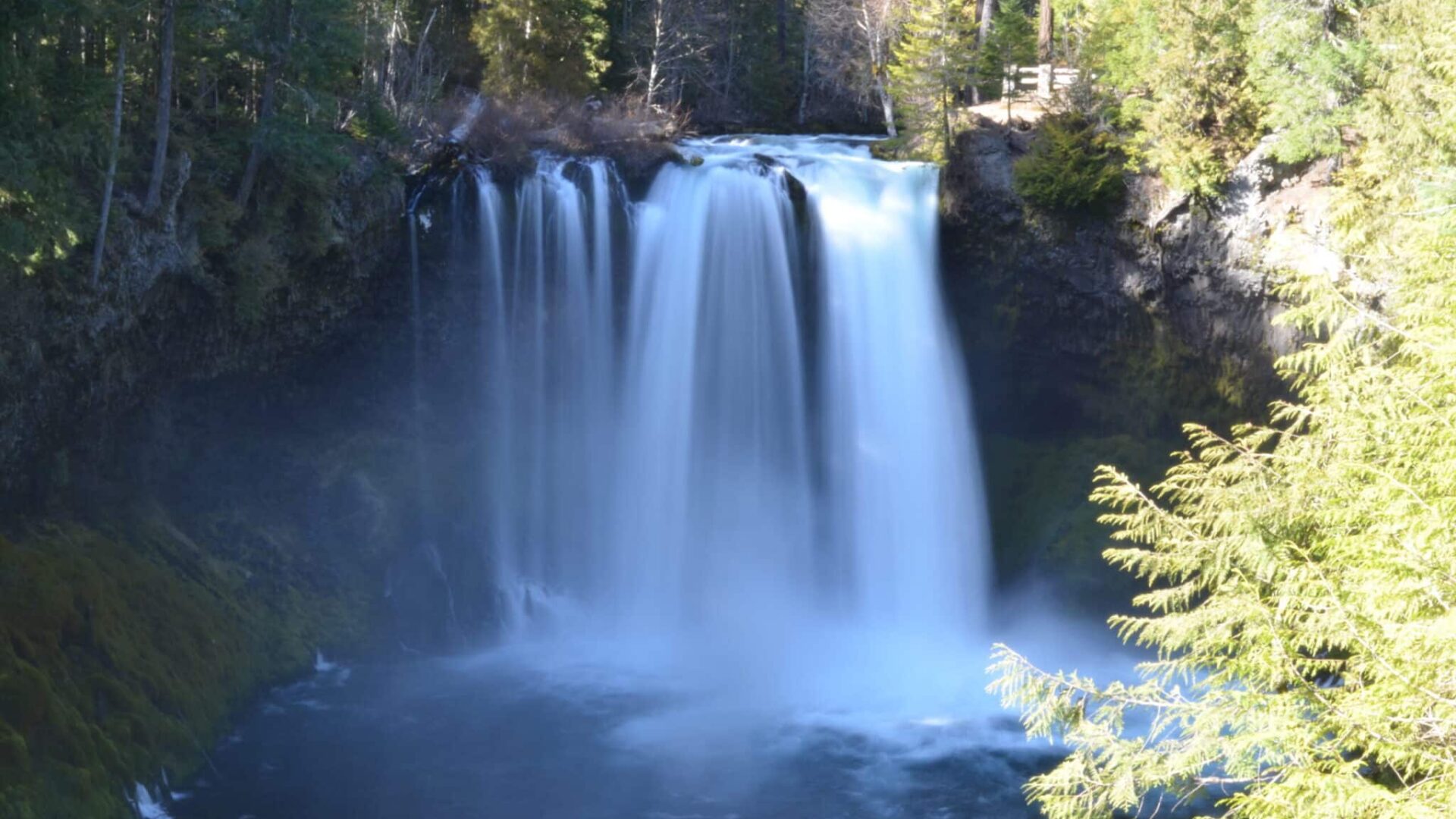 Koosah Falls and Waterfall Wednesday in Oregon
Koosah Falls on the McKenzie River Koosah Falls (#47 on the Oregon Trail of Waterfalls map) is the second of the three major
... more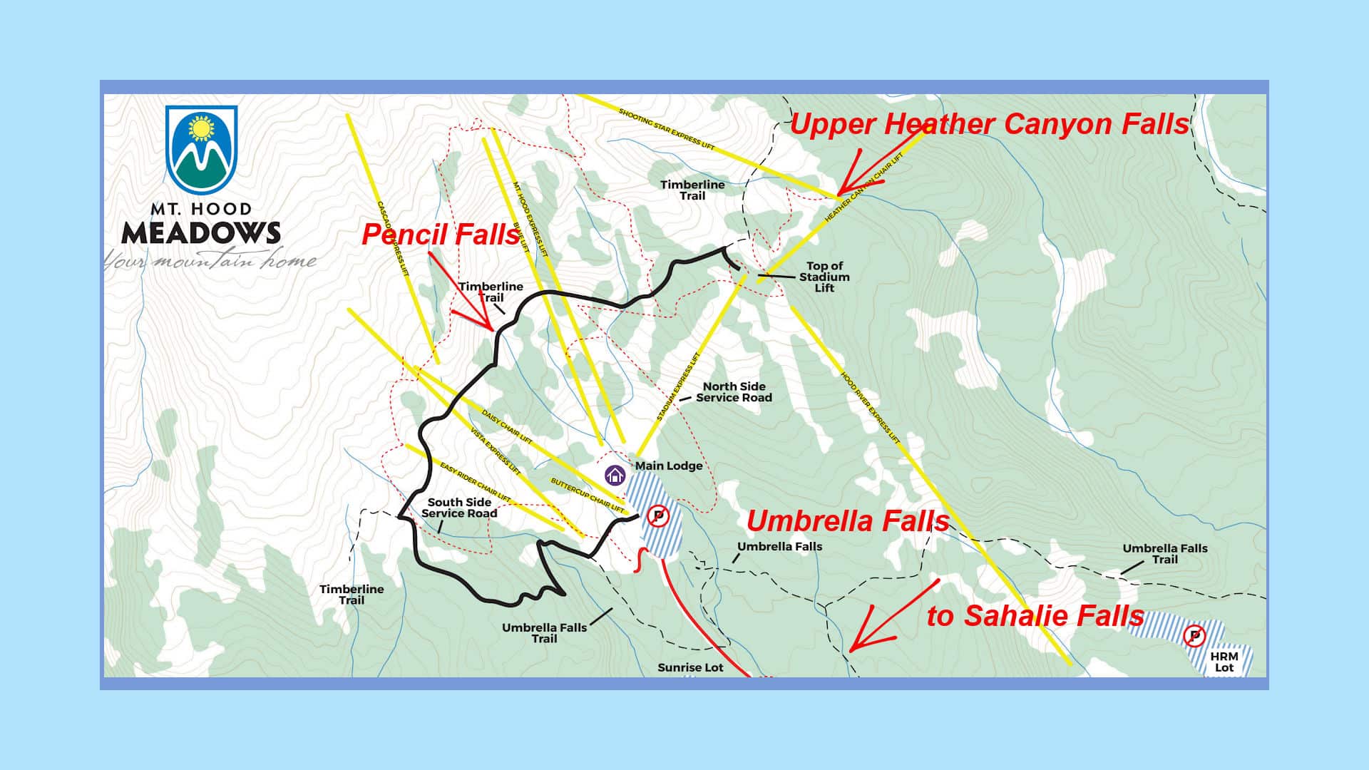 Umbrella Falls and Waterfall Wednesday in Oregon
With winter and spring come winter storms and snow pack melt, supplying Oregon scenic rivers the water needed to create our
... more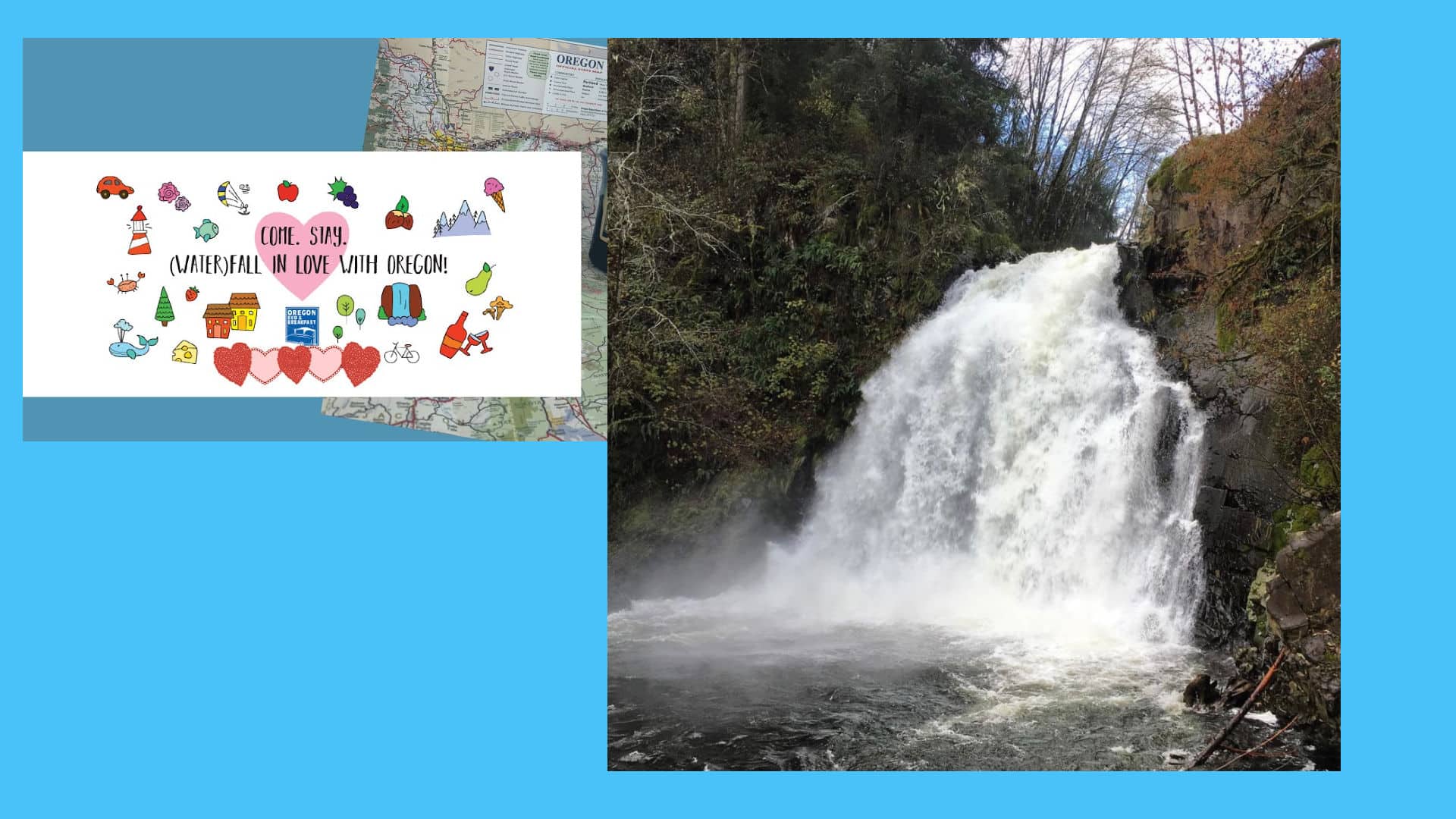 Youngs River Falls and Waterfall Wednesday in Oregon
‘Youngs River was discovered in 1792 by William Robert Broughton of the Vancouver Expedition, and named for Admiral
... more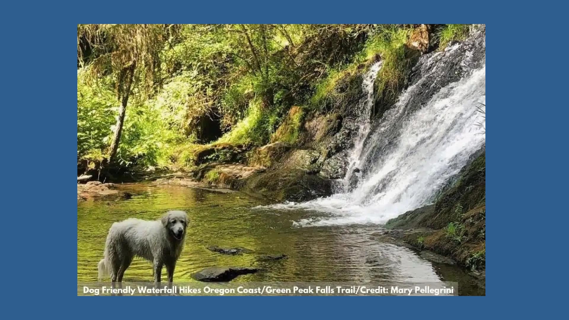 Alsea Falls and Green Peak Falls on Waterfall Wednesday in Oregon
Alsea Falls and Green Peak Falls Trail: Alsea Falls (W42) is the namesake and the first of two cascades on the Alsea Falls
... more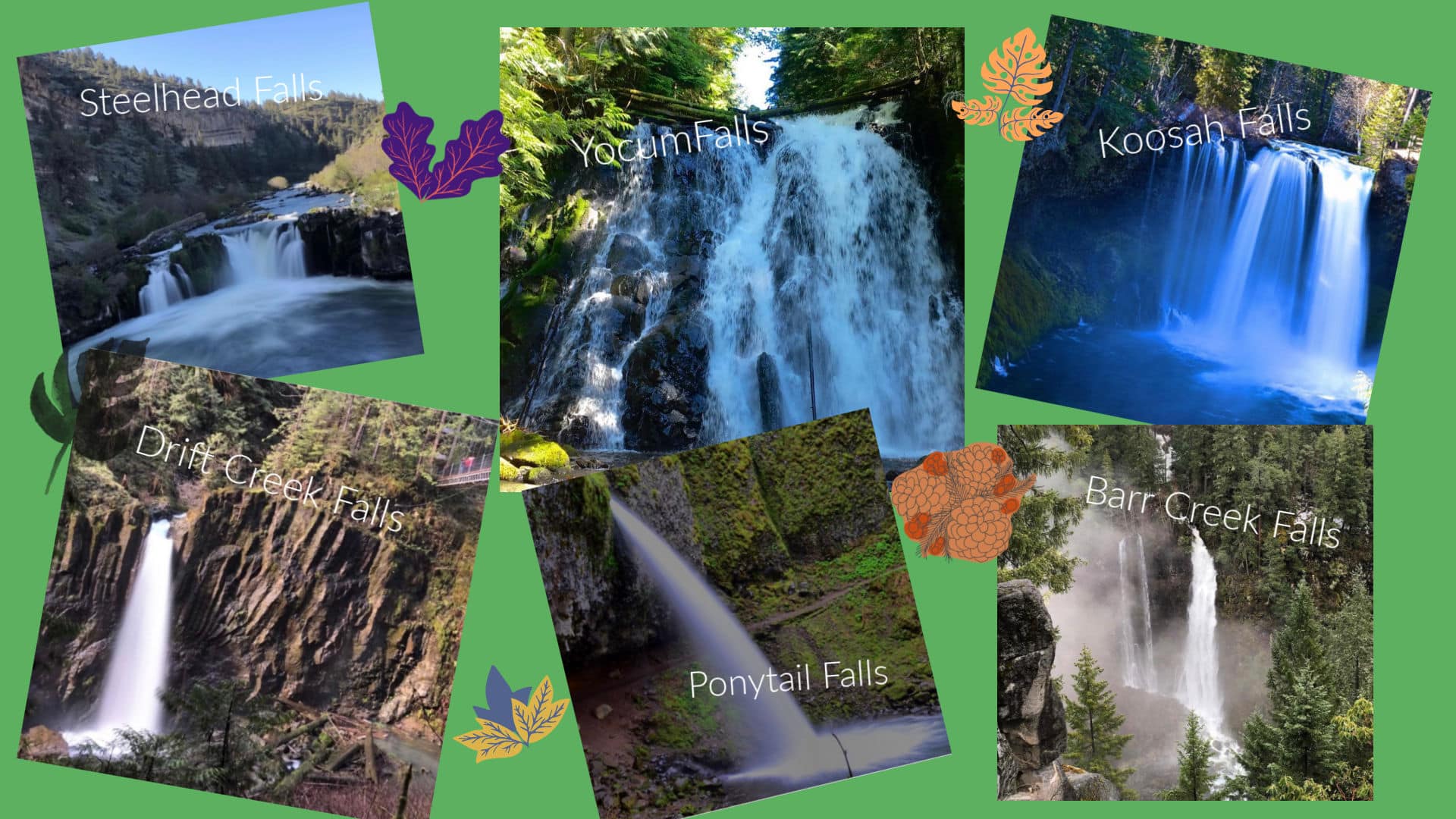 Prepare for Astounding Scenery at these Must-See Oregon Waterfalls
May is Mental Health Awareness Month. The Oregon Association of Independent Inns understands that even small actions can
... more Spring Showers and May Flowers in Oregon
Come feel the mist of Oregon waterfalls on your face! Spring showers don’t just bring May flowers in Oregon. They, along
... more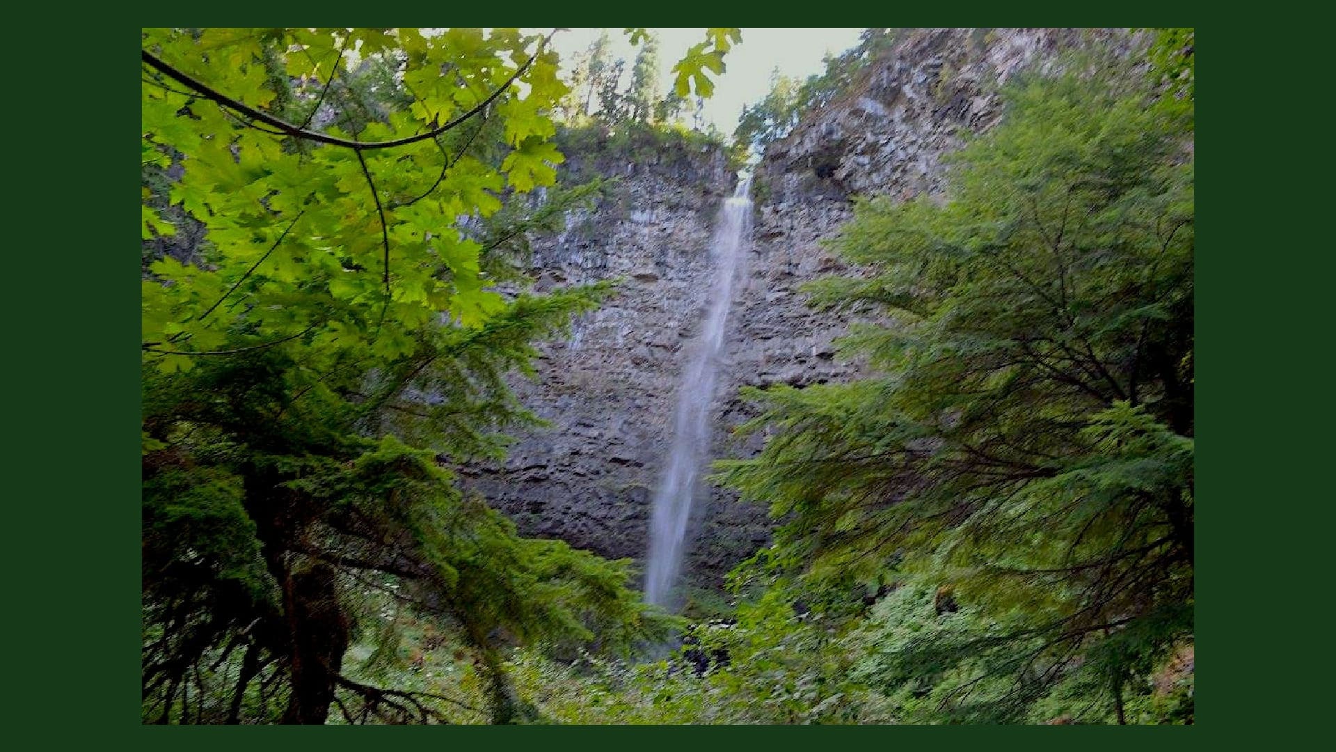 Watson Falls on this Waterfall Wednesday
Watson Falls is the tallest waterfall in the North Umpqua River basin and is often recognized as one of the tallest
... more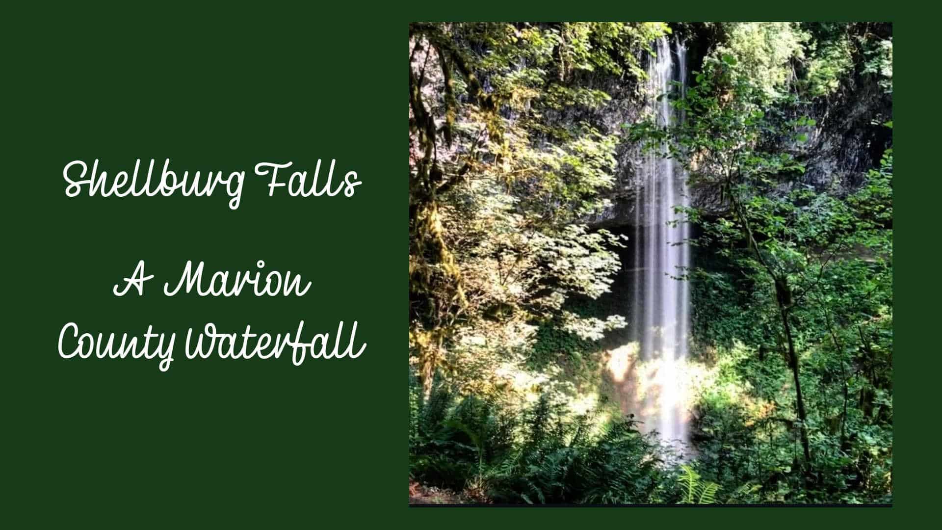 Shellburg Falls – a Marion County Waterfall
Shellburg Falls is the crown jewel of a narrow stretch of the Santiam State Forest tucked into the Stout Creek canyon. Here,
... more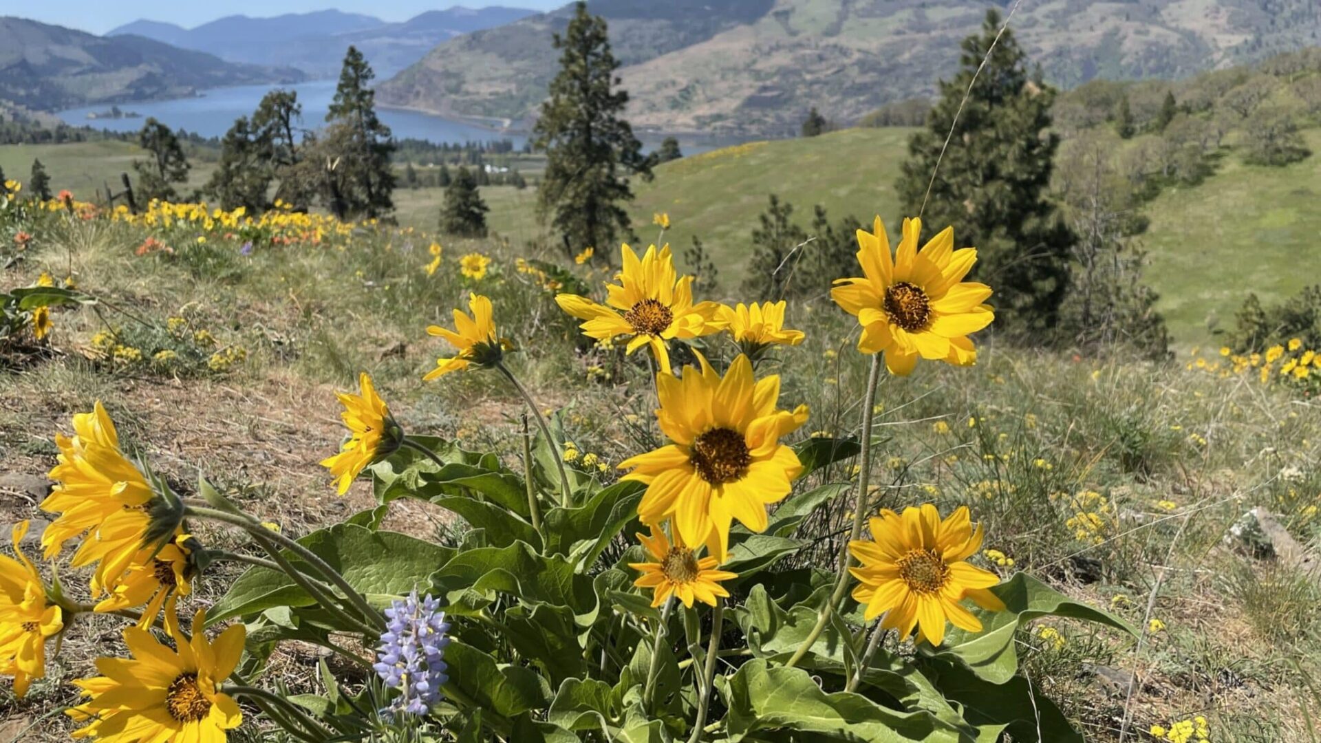 Glorious Oregon Wildflower Bloom, Scenic Rivers and Waterfalls
With winter and spring come winter storm and snow melt. Be prepared for Oregon’s wildly beautiful and renowned
... moreNorth Falls in Silver Falls State Park ~ Waterfall WednesdayWith winter and spring come winter storms and snow pack melt, supplying Oregon scenic rivers the water needed to create our
... more